If you venture off-road you need a rescue plan. If you are off-road with a vehicle, SxS, bicycles or motorcycles you also need a rescue plan for the vehicle. Don't break down or get injured with no way to get help. I always ride the motorcycle in groups, or with at least one other. I ride the eMTB alone at times but I always have communications and a plan.
Communications
I wrote a blog post a few years ago about rider-to-rider communications: https://jimroal.blogspot.com/2023/11/rider-to-rider-communication.html . After riding a few years more, both on the motorcycle and the eMTB, I realized that communication when off-road is very important. This includes communication with friends and family, and with emergency services. Too often we have accidents or break something when off-road. When this happens, we need a reliable way to contact people for help.
Satellite
The best way to communicate with people anywhere when outdoors and out of cellular service is via satellite. Some newer cellular phones have emergency satellite communications, and some even have broader use than emergency. Of course you can get a satellite phone but that is expensive. There are several satellite communicators made for outdoors activities from Garmin, Motorola, and others. I use the Garmin InReach Messenger for its relatively low cost, crazy long battery life, small size, and the InReach SAR rescue plan. It is important to setup and test this to make sure communications get through to the people you need them too. I have seen many with Garmin InReach but they have not set it up to communicate with family and friends. I highly recommend doing this! The InReach is not just for emergencies.
Garmin InReach has a feature that includes the GMS coordinates in every message. I highly recommend keeping that feature ON. It comes along for free with the messages you send.
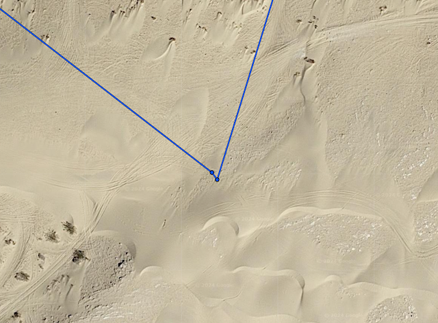
I use the tracking feature in the Garmin InReach and I share every ride with my wife. Every 10 minutes it updates my location that she can see on a map. I also share my location with her on Google Maps at all times, which works great until I am in an area with no coverage (which happens often). If I even just stop communication (tracking) she will know my last location within 10 minutes. The blue dots on the Garmin Explore map are those 10-minute updates.

GMRS Radios
Many of us only have messaging over satellite, so it is good to also have a GMRS radio. For this to work, you need multiple people to have them. The radios can be inexpensive and the 10-year FCC license is cheap and does not require a test like HAM. The radio give you a way to have voice conversation with multiple people from a reasonable distance of each other (several miles generally).
Cellular Phones
Cellular phones are great as that is now our primary communication device on a daily basis. However, off-road coverage can be spotty so don't depend on this. Ideally ride with a group that has a variety of carriers so at least one might have service at any given time. Someday (fairly soon) coverage will expand through low-earth orbit satellite systems.
Helmet Intercoms
Helmet intercoms (Cardo, Sena, etc.) are very short range, about a half a mile generally. Some can use cellular networks but that of course has the limitations described above. These devices are generally not for emergencies, unless you happen to have cellular communications at the time. However, the best way to survive a crash is to prevent the crash in the first place. The great thing about helmet intercoms is you can engage in fully hands-free conversation the whole ride. This does not mean you have to spend the whole ride talking. You can easily mute/unmute. The rider in front can warn the other riders of obstacles and vehicles ahead. This helps reduce the chance of accidents. This is very useful in dusty conditions as the riders behind the front have dust to deal with limiting their vision. If a rider does have a problem, they can immediately let the other riders know. This helps prevent a pileup when visibility is limited. You can also communicate navigation to the other riders as you approach forks in the trail. This helps prevent people getting off-route and lost.
Cardo and Sena have mesh systems which connect all the riders with their system making a daisy chain. This helps extend the communication distance as it hops rider-to-rider between the front and back. Unfortunately these 2 mesh systems are not compatible, but they are bridgeable. Each rider with a mesh intercom can also bridge in another rider with simple Bluetooth. It can be complicated to setup, and unreliable even when you get it setup. The mesh systems are the best so use that if you can.
I have a Bluetooth GMRS radio that connects to the helmet intercom (Cardo in my case) so I can use the radio while riding. I added a Bluetooth push-to-talk switch on my clutch lever making it easy to talk even while riding.
Starlink
I don't have Starlink so I can't speak to it much but this is another alternative communications mechanism.
Navigation and Maps
Never go off-road without mapping and navigation tools. I have several I keep on my phone including Google Maps, GAIA, OnX, and Trailforks. I also have Garmin Tread and a Zumo XT2 motorcycle navigation device. All of these have the ability to download offline maps which needs to be done before you get out of cellular coverage. When I plan hikes or rides, I always download offline maps before I leave the house.
When planning anything off-road, share the route with family so they know where you planned to go.
Rescue Plan
Think through what you will do when things go bad. It could be you get injured or your bike is unrideable for a variety of potential reasons. What now?
I made a Google Doc of my emergency plan and shared it with my family. It explains how to contact me with InReach and GMRS. It explains how to find me as well. I bought a pickup with off-road capabilities and equipped it with everything I would need to recover a motorcycle or bike off-road. I have 2 loading ramps, a winch, and plenty of tie-downs to secure the load well enough to haul it on rugged off-road trails.


If you get injured in an area unreachable by ambulance (pretty much all off-road) things can get crazy expensive fast. Medivac can run well over $50k and may not be covered by insurance. I have the Garmin SAR plan for this. I personally have never used it but I have heard of many who have. It is $40/year.
Rescuing
If you ever get that call or message that a friend is in trouble and needs a rescue, go prepared. Take the 10 minutes to clearly see where they are on a map and download any offline maps you will need (see "navigation and maps" above). Google Maps has some off-road navigation capability but it is not really good at it. I use OnX primarily for off-road navigation since it has much better coverage, and trail ratings. Next, get a clear communication plan with the person, including what GMRS channel they will be on and InReach address you can contact them on. Make a test InReach message to ensure you can communicate when you are offline. Have them share their GPS coordinates so you can navigate directly to them. Make the communication plan clear while you are in contact with them. Share this information with others before you go. Have a rescue plan for yourself as well in case you run into trouble yourself. Bring food and water for both yourself and the people you are rescuing. Also bring any necessary tools, parts, and first-aid supplies. Go prepared as you would when heading off-road.
Ideally the group needing a rescue would have shared their route plan before the ride. We generally do this with a Facebook event, sharing the OnX or GPX route, or both. It is best to follow their route to navigate to them and tell them the route you plan to take before leaving home.

A rescue is bad enough, don't make it a double rescue! Leaving someone waiting with little to no communication is a big problem. At what point do they need to get out before dark? How long do they wait? They are left wondering if you are still coming at all. Ideally have at least 2 people at the location where the rescue is needed. Don't leave a person waiting there alone.


%20Map%20&%20Information.png)